Regional Flood Planning Groups
 The TWDB hosts a region-specific webpage for each planning group that contains a general description of the region, the list of counties that lie within the regional boundary, and meeting updates. To view a region of interest, please click the region's name in the list.
Search by address to find your Flood Planning Region
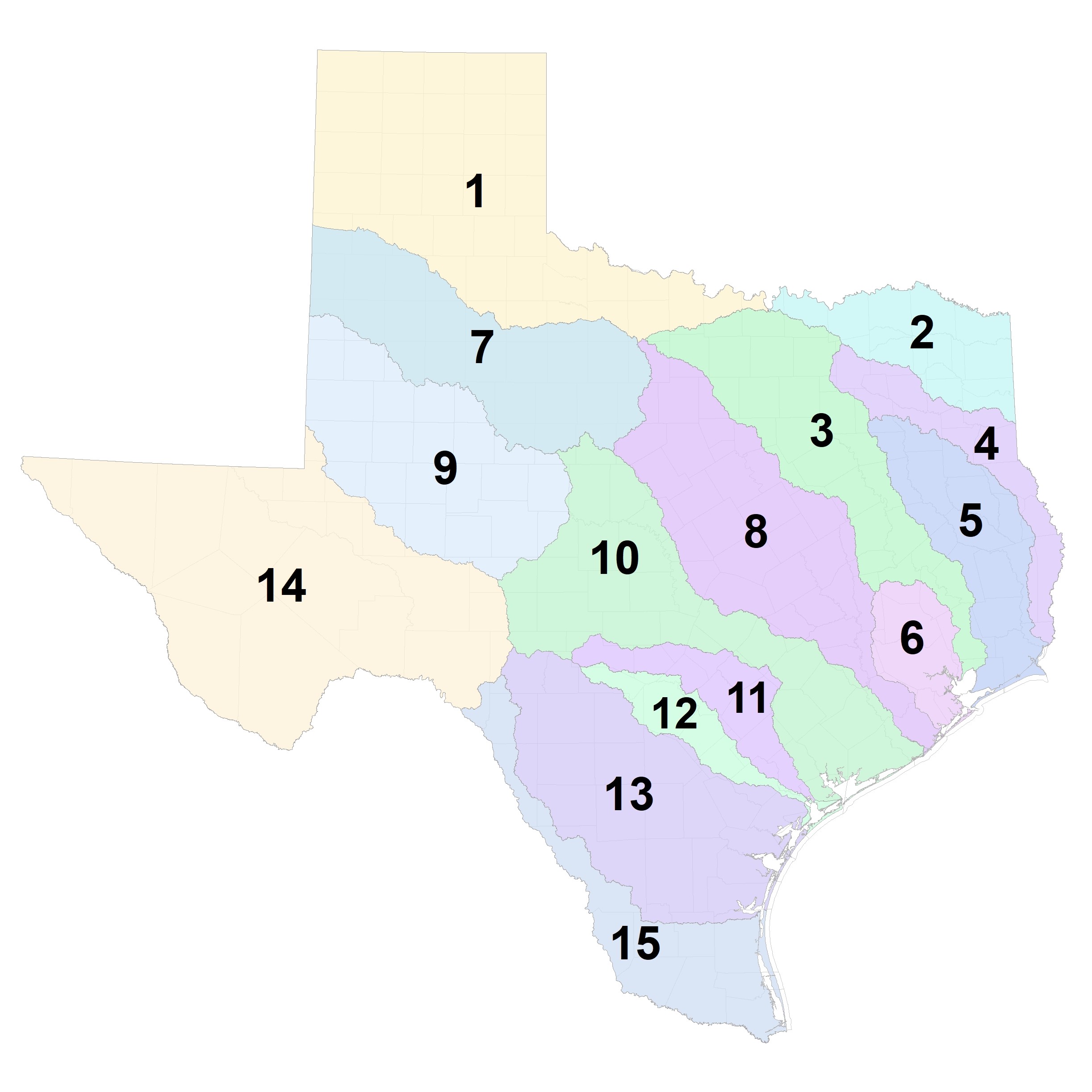
- Region 1 Canadian-Upper Red
- Region 2 Lower Red-Sulphur-Cypress
- Region 3 Trinity
- Region 4 Sabine
- Region 5 Neches
- Region 6 San Jacinto
- Region 7 Upper Brazos
- Region 8 Lower Brazos
- Region 9 Upper Colorado
- Region 10 Lower Colorado-Lavaca
- Region 11 Guadalupe
- Region 12 San Antonio
- Region 13 Nueces
- Region 14 Upper Rio Grande
- Region 15 Lower Rio Grande
For a map of all 15 flood planning regions, please see one of the following:
- Large format flood planning region map
- Small format flood planning region map
- Maps of individual Flood Planning Regions
Regional Flood Planning Group Contacts
The TWDB compiles information provided by each of the regional flood planning groups (RFPG) for voting and non-voting members, and Planning Group Sponsors. This information is delineated by flood planning region in the reports below.
- Regional Flood Planning Chairs (12/1/23)
- Regional Flood Planning Sponsors (12/1/23)
- Regional Flood Planning Full Member List (12/1/23)